July 9, 2024
Blueberry Hill Campsite to Silver Creek Campsite
19.6 miles by SHT
Actual miles hiked: ~17.5
I jolt awake with my alarm completely disoriented. I did that thing again last night where I had to pee really bad but just didn’t want to get up so instead I lay there uncomfortable, awake, for hours instead of taking care of my bodily needs like an adult. When I did eventually get up, the mosquitoes found me instantly, but at least I could get another hour of sleep. Point is: I’m tired.
There are slugs and bugs and it’s so humid as I slouch through my morning coffee and breakfast. Machine goes to the latrine and comes back irate. “This is officially the worst tent site,” he says. “It was overflowing and there were like ten million mosquitoes.” He dives in his tent and starts murdering skeeters. “Man, minute to minute this trail fucking sucks,” he says.
“Yeah. It does.”
“What were we thinking? Hiking this now?” he asks. “We should make a public service announcement that’s like, ‘Friends don’t let friends hike the SHT in the summer.’”
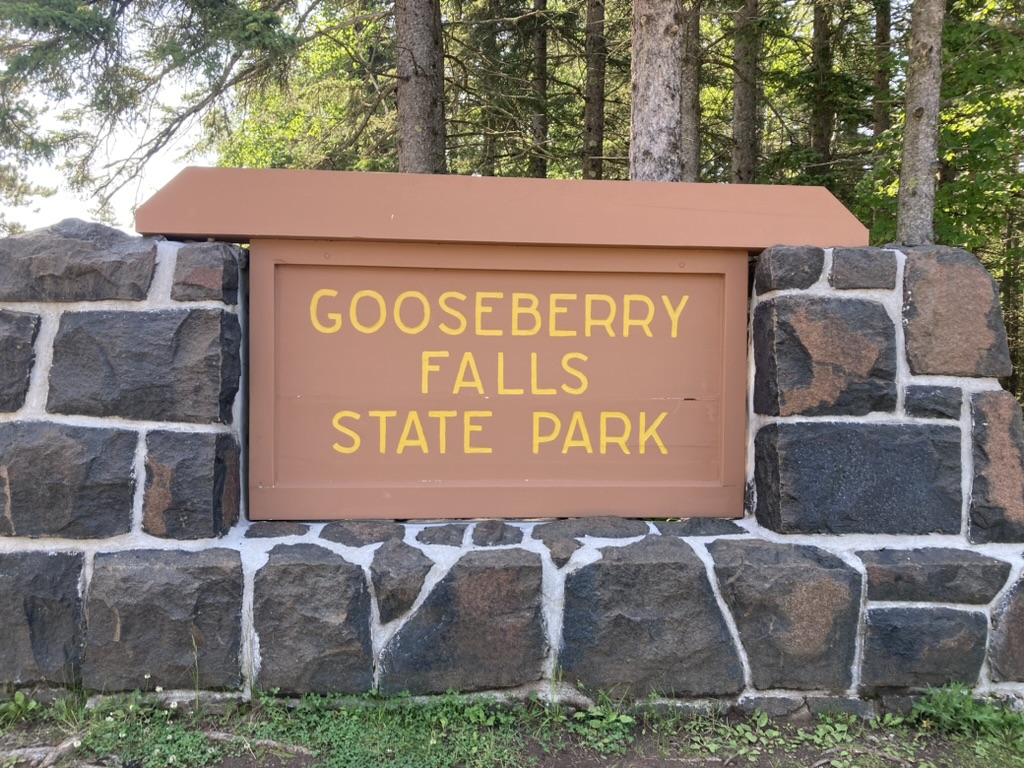
We continue packing up and complaining and getting ready grudgingly. We talk over the day. The guidebook has us going down a road walk and on our friend the Gitchi-Gami, but the SHT made an official new route that just grazes the corner of Gooseberry Falls State Park. Which, just why? Why does the official trail avoid all the cool stuff? The old road walk + Gitchi-Gami route is longer, but given how absolutely awful the mud was yesterday afternoon, we decide to take that alternate instead. Whatever. This is the SHTchi-Gami now. The only goal we have remaining is to get to the end of our continuous footpath and to try to enjoy some interesting things along the way.

We hike the 0.1 to the road and of course, the new trail across the way looks pristine. We walk a little bit of it just to see what it looks like and start doubting our decision. Should we just bypass Gooseberry Falls in favor of the new trail? Or skip this potentially beautiful walking in favor of seeing the waterfalls?
Eventually the falls win out, because why are we even doing this if we aren’t going to see cool stuff? The road is beautiful and easy to walk on. When we get to 61 we cross it and find our old friend the Gitchi-Gami, which we walk on for a bit until we arrive in the park.

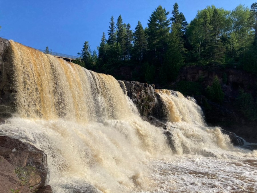
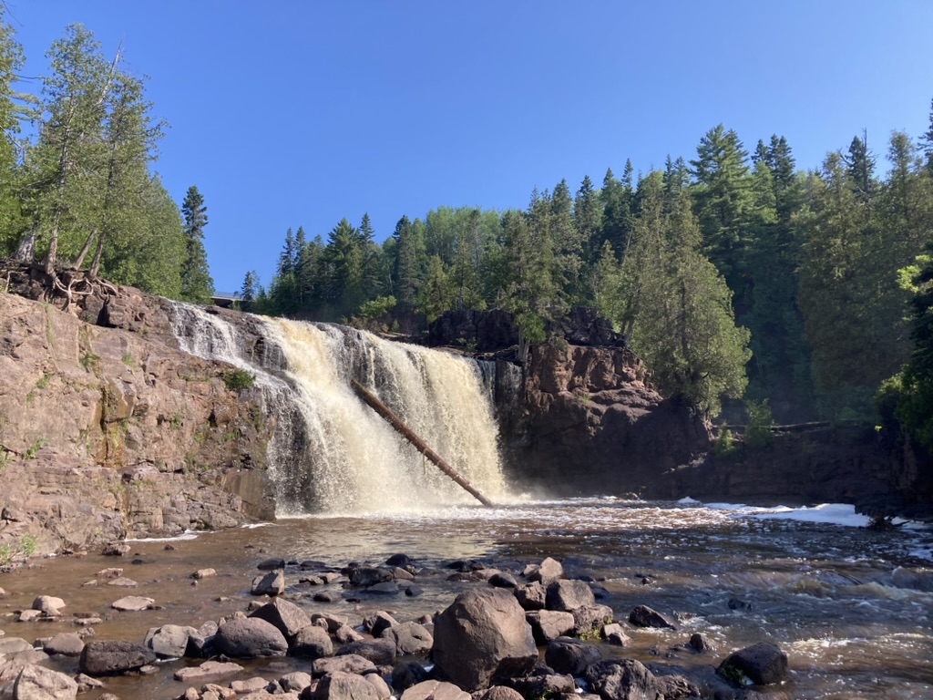
The falls are pretty much directly under the bridge, and they are magnificent. There is an upper, middle, and lower falls section, and we walk out to see them all beginning with the upper falls. We’ve seen a lot of powerful water on this hike, but these are particularly impressive.


We walk to the visitor’s center, which isn’t open for business yet but which does have vending machines, trash cans, restrooms, and a water bottle refilling station that we happily make use of. All around us, as we sit on the bench and wait 10 minutes, there are people grumbling about how the center doesn’t open until 10 and how ridiculous it is, and it’s suddenly very annoying to be around this many people again. I take a spin through the gift shop when it opens and it’s a very disappointing gift shop, I’m sorry to say, so I just get a postcard and get more change for the vending machine, which we use to get sodas to pack out.
We escape the park via the parking lot and then the road. The lot is jam packed and I’m grateful to be vehicle-less in this moment. We spot a Gitchi-Gami sign and take photos with it since this is where it stops and we won’t have our old friend to bail us out anymore when the SHT gets too shit. Thanks for everything, Gitchi-Gami!
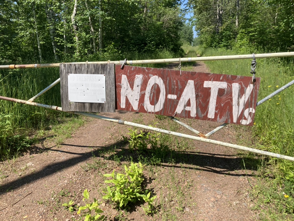
Our plan from here was originally to road walk along 61 for a minute and then hop on the road (ATV track? Trail?) that we see on Avenza labeled “Nester Grade.” But when we get there and start walking we see a “private property” sign first on a tree and then on a gate later on that also reads “No ATVs” and if suddenly feels like we shouldn’t be here, so we turn around and go back to the highway, where we review our options.
The spur trail to the SHT in Gooseberry is apparently pretty damaged from the flooding last month, and anyway, backtracking is not fun. We examine the map a little further and see a junction farther south on 61 with a county road that connects back with the SHT. We decide on that, because even though it’s highway, even though it’s hot, even though we skip a lot of trail, it’s still better than slop and still better than risking terrible terrain on the spur. What does it say about your trail if a walk along a major state highway is more enjoyable than taking the official trail?
That isn’t to say that I enjoy the highway walk, because I don’t. It’s exposed and scary and so painful on my feet. But it’s not far, and we can really move on this type of surface.
A little while down the road we see a sign in the distance.
“What does that say?” Machine asks.
I screw up my eyes. “Grill? Lunch? Bar?”
We get closer and the words reveal themselves as “Gifts” and “Local Arts and Crafts.” Ok, I want to check it out, but less exciting than “grill” or “lunch” or “bar” in this moment. But then I look across the street and see the Grand Superior Lodge, and underneath, the phrase “Grand Superior Burgers” next to “Try our new menus.”
“AH!” I exclaim ecstatically. “I will try ALL of your menus!”
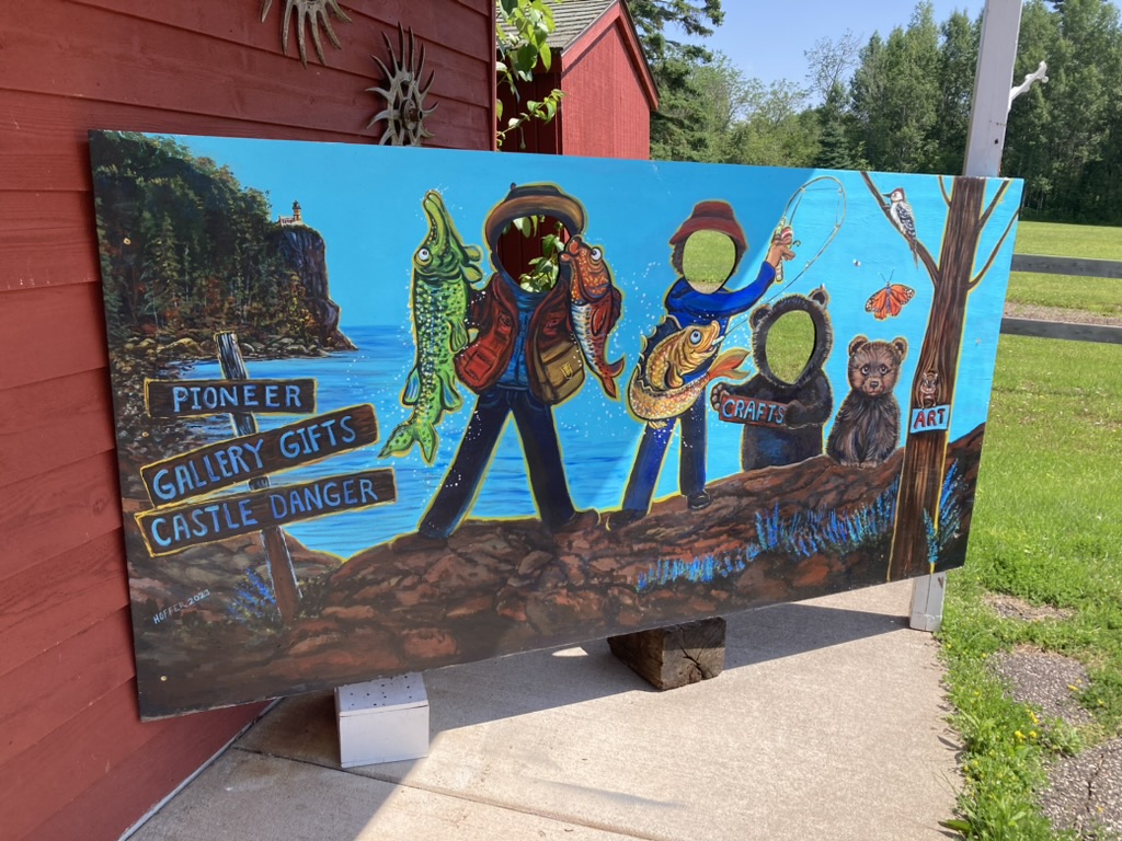
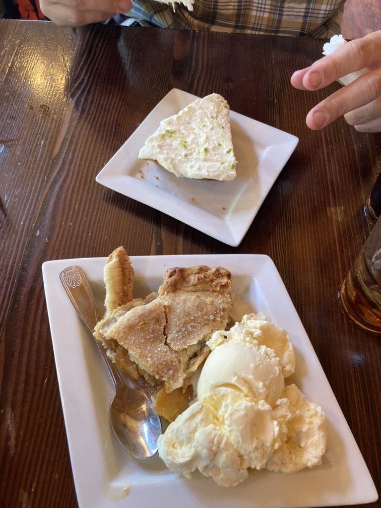
We take a spin through the local art shop first, which is cute but nothing strikes me, and then we consult Google on the restaurant across the street. It looks kind of pricey, but I see just down the road that there’s a place called the Rustic Inn that is at our turn, and they have lunches and pies. That’s our choice.
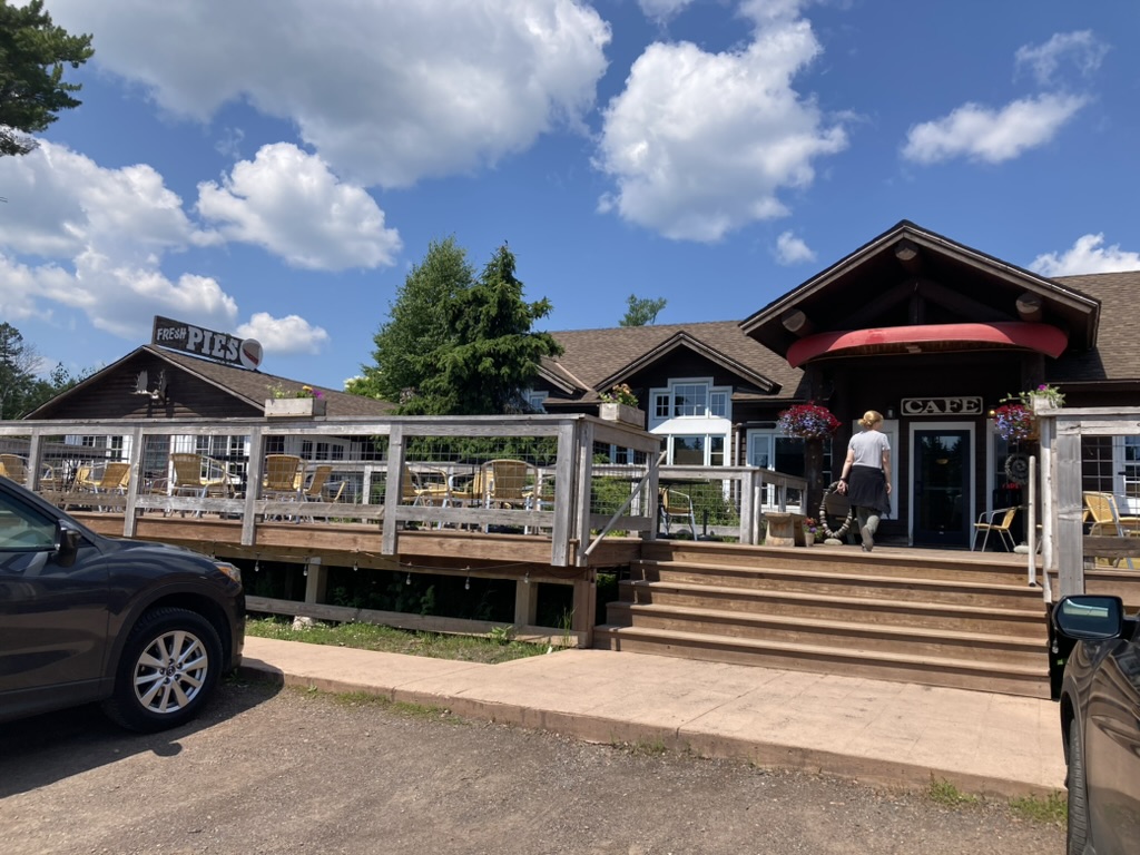
It is a very, very good choice. We slip in just before the lunch crowd and get a table. They have dark, strong, frigid iced tea, just the way I like it. I order the turkey sandwich combo, while Machine gets the fried fish sandwich. My turkey sandwich is an absolute masterpiece: thick homemade cranberry and wild rice bread, juicy turkey, all the toppings. It is divine. It’s definitely in my top 5 best sandwiches ever. It might be THE best turkey sandwich I’ve ever had.
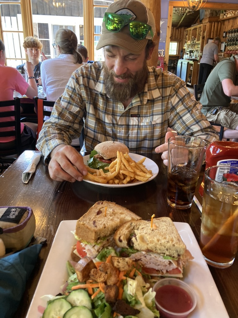
And then there is pie. I get peach with ice cream and Machine gets key lime. We both love our key lime pie tart, subtle, and fresh, and this is a damn great pie that meets all the criteria. My peach pie is warm and the peaches are a perfect melt-in-your-mouth sweet. I don’t actually start crying, but I kind of want to.
We pay the price a little for this meal as we start walking. I am overfull and hot once I a back in the sun. But it was worth it.
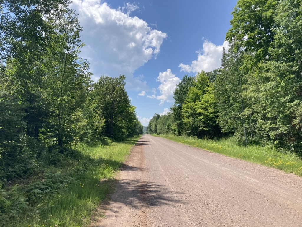
We walk down the gravel county road to the trailhead, which is not comfortable in the blazing sun, but it is fast and we get it done. At the parking for the SHT we spot a couple having a drink at a table in shade. We get chatting and they offer us cold drinks and cucumbers. Trail magic! Our first trail magic of the SHT! The seltzer is divine even if it makes me a little too full and eepy, and the cucumber will taste excellent in this heat. The couple is from the Twin Cities and they said they like to come out here when they have the chance and do pieces of the trail. This time they were taking it easy and doing little sections in between hanging out at the car. Sounds great to me right now.
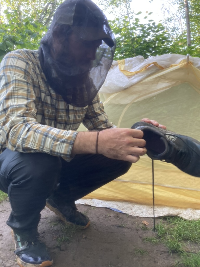
We thank them and head back into the woods for our last seven miles of the day on actual trail. It’s immediately slop and bugs. Today’s section is all along private land, so the trail does weird things with 90-degree turns along property lines. Much of this is very steep hill, and much of it is overgrown slop, but there is one very nice section along a ridge scattered with pines. At one point I decide to have a little break sitting on the soft ground. Machine comes to join me, realizes his head net is missing, and has to go back for it. Meanwhile I find a tick on me, and when Machine returns he finds another. This trail, man. Can’t you let me relax and enjoy myself for five minutes?

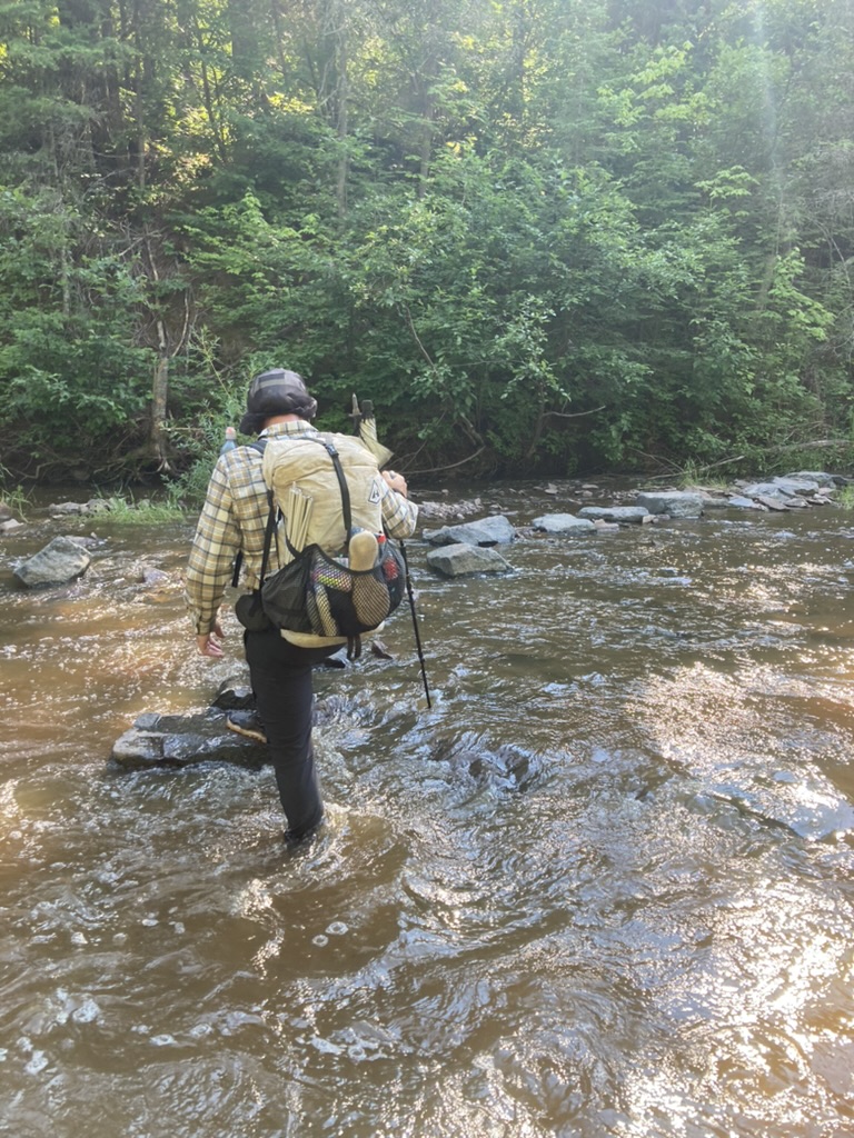
There is an exciting water crossing along the Encampment River, another random logbook nailed to a tree, an even more random plastic chair in the middle of the trail, and a nice overlook. The trail descends from the overlook into a flat section that bisects several roads.

At first this flat section is nice. It’s slightly muddy but nothing crazy. But then we cross the final road to begin our last mile of trail before camp, and it turns into the nastiest, thickest, longest stretch of muddy slop I’ve seen on this entire hike. It is relentless. There are only brief pauses of solid ground before it goes back to mud. At first I just put my head down and try to stay as dry as I can, but eventually I can’t avoid it and I start to feel my blood boil. I have a little meltdown and slam my poles into the ground and call the SHT some choice names as I inadvertently splash more mud farther up my leg. I am just so deeply, entirely done with this trail. The mud is my nemesis. It sucks, it removes all joy from the movement of hiking, it’s disgusting.

We finally arrive at camp and I set up my tent as fast as I am physically capable of doing and dive in. I take care of all of my cleaning and setting up tasks while I cool down. Why do we do this again? Is this fun? Thank God it’s another town day tomorrow and we can escape the mud.
